I saw one over at the Oakland Museum. But there is also information of swell direction, current strength and other info woven into that chart. I was fascinated, tbh. The actual workings hasn't made it to google, probably because those who know can't work a mouse.Montegriffo wrote:No but I do have a vague memory of seeing it explained on TV once. My guess would be that the beads represent islands and the lines distances. If you know the bearings between islands you can work out where you are by line of sight much like coastal navigation where you can check the bearings of two known landmarks and plot your position using trigonometry.
Exotic corner of history before the French Revolution you want on Westworld?
-
Haumana

- Posts: 4197
- Joined: Wed Nov 30, 2016 9:48 am
Re: Exotic corner of history before the French Revolution you want on Westworld?
-
Montegriffo

- Posts: 18794
- Joined: Wed Nov 30, 2016 7:14 am
Re: Exotic corner of history before the French Revolution you want on Westworld?
Well wave directions is a useful navigation aid, I think the Vikings used it to verify their sun compasses.
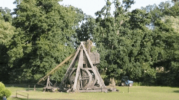
For legal reasons, we are not threatening to destroy U.S. government property with our glorious medieval siege engine. But if we wanted to, we could. But we won’t. But we could.
-
Montegriffo
- Posts: 18794
- Joined: Wed Nov 30, 2016 7:14 am
Re: Exotic corner of history before the French Revolution you want on Westworld?
I like the way there are a couple of beads outside the grid, recently discovered islands maybe?
For legal reasons, we are not threatening to destroy U.S. government property with our glorious medieval siege engine. But if we wanted to, we could. But we won’t. But we could.
-
Montegriffo
- Posts: 18794
- Joined: Wed Nov 30, 2016 7:14 am
Re: Exotic corner of history before the French Revolution you want on Westworld?
Not too much info here
https://en.wikipedia.org/wiki/Polynesian_navigation
seems to be islands wind and wave directions. Mentions celestial navigation being easier because of the whole celestial sphere being exposed.
https://en.wikipedia.org/wiki/Polynesian_navigation
seems to be islands wind and wave directions. Mentions celestial navigation being easier because of the whole celestial sphere being exposed.
For legal reasons, we are not threatening to destroy U.S. government property with our glorious medieval siege engine. But if we wanted to, we could. But we won’t. But we could.
-
Haumana
- Posts: 4197
- Joined: Wed Nov 30, 2016 9:48 am
Re: Exotic corner of history before the French Revolution you want on Westworld?
I googled the shit out of those charts a few months back but I still couldn't tell anyone how they work. They are like a puzzle with a ton of pieces missing. I can only begin to rough out how they might have been useful.Montegriffo wrote:Not too much info here
https://en.wikipedia.org/wiki/Polynesian_navigation
seems to be islands wind and wave directions. Mentions celestial navigation being easier because of the whole celestial sphere being exposed.
-
Ex-California

- Posts: 4116
- Joined: Tue Nov 29, 2016 11:37 pm
Re: Exotic corner of history before the French Revolution you want on Westworld?
Polynesian Navigation was on another level from every other culture.
No man's life, liberty, or property are safe while the legislature is in session
-
Montegriffo
- Posts: 18794
- Joined: Wed Nov 30, 2016 7:14 am
Re: Exotic corner of history before the French Revolution you want on Westworld?
A lot of it was island hopping. If you knew the direction of the next island in a chain you could head off and try really hard to maintain a straight course. The link also mentions using birds, you release one when you think you are near an island and follow it, if it cant find one it returns. The Vikings definitely employed this method with land based birds such as the raven.
For legal reasons, we are not threatening to destroy U.S. government property with our glorious medieval siege engine. But if we wanted to, we could. But we won’t. But we could.
-
Penner

- Posts: 3350
- Joined: Tue Nov 29, 2016 10:00 pm
Re: Exotic corner of history before the French Revolution you want on Westworld?
Isn't it believe that the Polynesians used to use the stars to navigate between islands?Montegriffo wrote:A lot of it was island hopping. If you knew the direction of the next island in a chain you could head off and try really hard to maintain a straight course. The link also mentions using birds, you release one when you think you are near an island and follow it, if it cant find one it returns. The Vikings definitely employed this method with land based birds such as the raven.
-
Haumana
- Posts: 4197
- Joined: Wed Nov 30, 2016 9:48 am
Re: Exotic corner of history before the French Revolution you want on Westworld?
Yep. But there was some stuff I read of how they made the hop from Hawaii to South America. That ain't just following coastlines around to get to Canada.Montegriffo wrote:A lot of it was island hopping. If you knew the direction of the next island in a chain you could head off and try really hard to maintain a straight course. The link also mentions using birds, you release one when you think you are near an island and follow it, if it cant find one it returns. The Vikings definitely employed this method with land based birds such as the raven.
-
Montegriffo
- Posts: 18794
- Joined: Wed Nov 30, 2016 7:14 am
Re: Exotic corner of history before the French Revolution you want on Westworld?
Yeah some of those island hops are huge, Easter island for example is a long way from any others in a chain.Haumana wrote:Yep. But there was some stuff I read of how they made the hop from Hawaii to South America. That ain't just following coastlines around to get to Canada.Montegriffo wrote:A lot of it was island hopping. If you knew the direction of the next island in a chain you could head off and try really hard to maintain a straight course. The link also mentions using birds, you release one when you think you are near an island and follow it, if it cant find one it returns. The Vikings definitely employed this method with land based birds such as the raven.
For legal reasons, we are not threatening to destroy U.S. government property with our glorious medieval siege engine. But if we wanted to, we could. But we won’t. But we could.